Cart
You have no items in your shopping cart
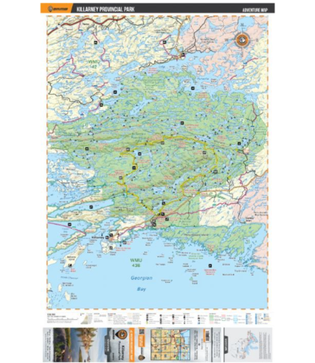
Dimensions: 61 x 94 cm (24 x 37 Inches)
Maps: 1:75,000
Digital Format Available: Yes, see the Digital tab for details.
Map Features: Highways, Logging Roads, Land & Water Features, Parks, Adventure Points of Interest, Campgrounds, Hiking Trails, Motori
Read more..
Dimensions: 61 x 94 cm (24 x 37 Inches)
Maps: 1:75,000
Digital Format Available: Yes, see the Digital tab for details.
Map Features: Highways, Logging Roads, Land & Water Features, Parks, Adventure Points of Interest, Campgrounds, Hiking Trails, Motorized Trails, Paddling Routes, Hunting & Fishing Areas, Winter Recreation and More.
Areas Covered: Killarney Provincial Park, Killarney, Baie Fine, Bell Lake, Crooked Lake, George Lake Campground, Johnnie Lake, Kakakise Lake, La Cloche Mountains, La Cloche-Silhouette Trail, Lake Panache, Nellie Lake, Threenarrows Lake, Northern Ontario, Canada
0 stars based on 0 reviews
Add your review