Cart
You have no items in your shopping cart
This recreation topographic map for Sturgeon Falls highlights all the logging/resource roads, hunting areas, fishing lakes & streams, campsites, paddling routes for canoeing and kayaking, wildlife viewing areas, multi-use trails for hiking, biking, h Read more..
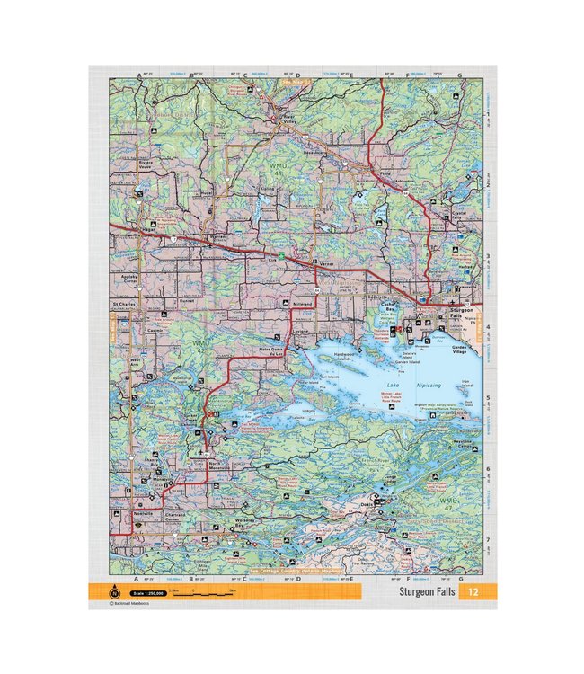
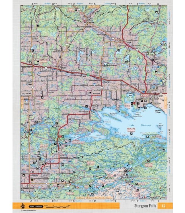
This recreation topographic map for Sturgeon Falls highlights all the logging/resource roads, hunting areas, fishing lakes & streams, campsites, paddling routes for canoeing and kayaking, wildlife viewing areas, multi-use trails for hiking, biking, horseback riding, cross-country skiing and snowshoeing, motorized trails for ATVing and snowmobiling & more. Covering 3,040 km2 (1,170 mi2), this 1:85,000 scale map is available in digital or trackable PDF format to use on several 3rd Party apps including Avenza, Locus Maps and Topo Maps+. New features include Crown land areas, countless new roads and trails plus additional recreational Points of Interest. Included on this map are Lake Nipissing, Sturgeon Falls, Cache Bay, Sturgeon River, Frence River, French River Prov Park, Tomiko Lake and more!
This map also covers the following Wildlife Management Units: WMU 41, WMU 42, WMU 47.
0 stars based on 0 reviews
Add your review